Huron & Erie Lakes Marine Map 3.5
Paid Version
Publisher Description
LAKE HURON, LAKE ERIE & LAKE ST. CLAIR COMBINED.
THE ALL NEW ADVANCED MARINE RASTER NAUTICAL CHARTS APP FOR BOATERS AND SAILORS!
THIS MAP PROVIDES ALL THE NECESSARY TOOLS FOR EASY NAVIGATION ON WATER. CONTINUOUS CHARTS DISPLAY MAKES IT MORE EASIER FOR SAILING AND AS THERE WILL BE NO INTERNET ON SEA, THIS CHART IS FASTER FOR NAVIGATION.
NO WAITING TIME FOR NAUTICAL CHART DOWNLOADS. READY TO USE, SEAMLESS FOR CONTINUOUS NAVIGATION!
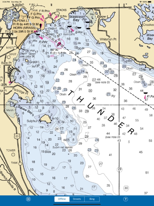
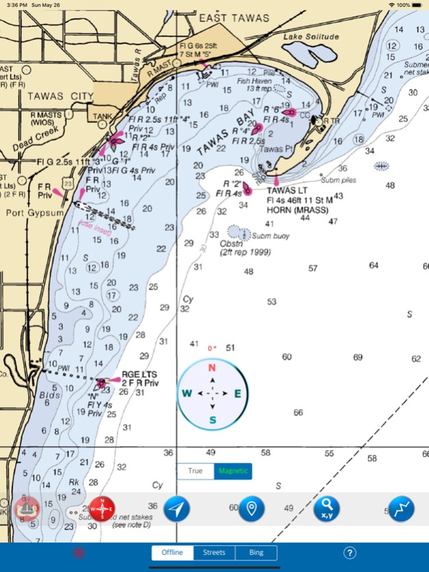
COMBINATION OF COASTAL CHARTS, SMALL CRAFT AND HARBOR CHARTS FOR EASY NAVIGATION.
ALL CHARTS OVERLAY IS ARRANGED IN A SEAMLESS ORDER, BASED ON CHART SCALE AND PRIORITY.
NO NEED TO CHANGE CHARTS MANUALLY, THEY ARE READY FOR CONTINUOUS NAVIGATION.
● ALL MARINE RASTER NAUTICAL CHARTS ARE FROM NOAA SOURCES.
● ALL CHARTS ALIGNED WITH ORIGINAL CHART CO-ORDINATES, ARE ACCURATE FOR USE.
● GPS - SHOWS & UPDATES USER CURRENT LOCATION ON MAP.
● SEAMLESS CHART OVERLAY DISPLAY, USE THEM AS LONG AS YOU BOAT.
● HIDE AND SHOW CHART OVERLAY TO SEE DIFFERENCE IN AERIAL OR OTHER MAPS.
● INTERACTIVE COMPASS, MOVE AND PLACE ANYWHERE ON MAP SCREEN.
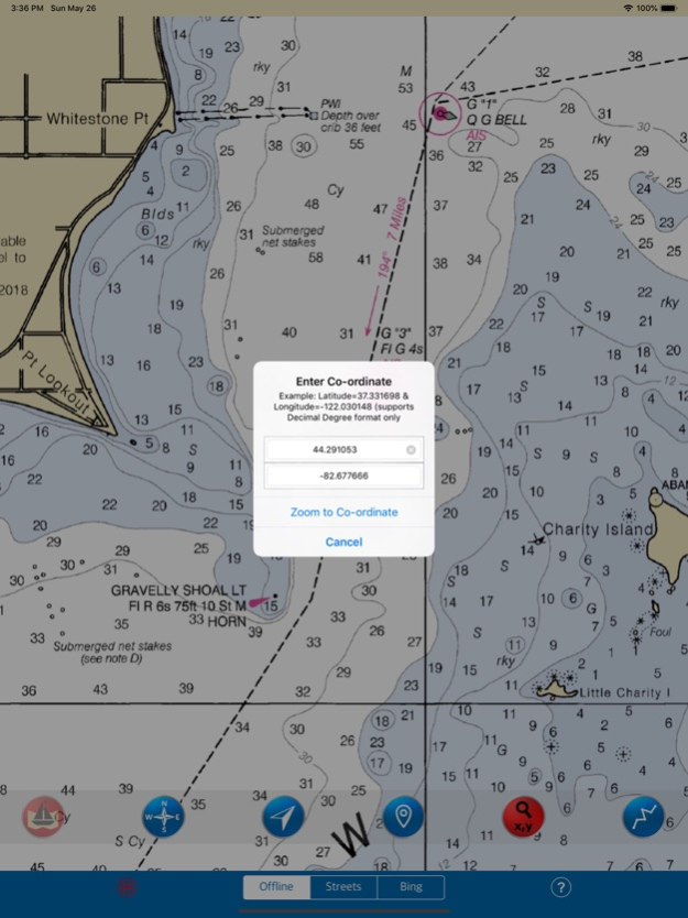
● KNOW ANY LOCATION COORDINATE WITH A SINGLE TAP.
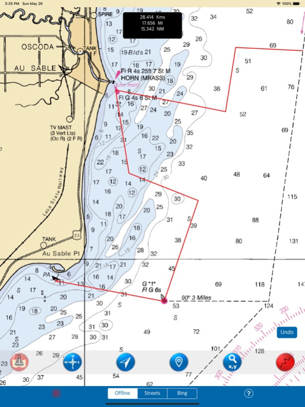
● FIND DISTANCES WITH ROUTE TOOL, DRAW ON MAP AND NAVIGATE ALONG THE ROUTE.
● GOTO MAP LOCATION BY ENTERING LATITUDE/LONGITUDE.
● INSERT UNLIMITED FAVOURITE MARKERS ON MAP. PHOTO TAGGED FACILITY FOR MARKERS WITH EMAIL OPTION. ADD MULTIPLE PHOTOS TO FAVOURITE MARKERS (MAX 3 ALLOWED). EMAIL FAVOURITE MARKERS AS KMZ FILE.
● MAP USER INFORMATION.
NOTE: All charts are Geo-positioned to match the exact location of features displayed on charts but there may be some difference between the positions of actual objects that are in the water or sea and charts because of the different chart scales.
Disclaimer: The Raster Nautical Charts data provided in all charts is from NOAA and is for reference purposes only and not for navigation.
We strive to provide the best products to the customers. Any suggestions from the users of this product are welcome to make the app more useful.
HAPPY BOATING AND SAILING ALL THE TIME!
May 20, 2020
Version 3.5
- Important bug fixed when map not showing in lower zoom levels in iOS 13.
- Supports new devices and Compatible to iOS 13.
About Huron & Erie Lakes Marine Map
Huron & Erie Lakes Marine Map is a paid app for iOS published in the Recreation list of apps, part of Home & Hobby.
The company that develops Huron & Erie Lakes Marine Map is Vishwam B. The latest version released by its developer is 3.5.
To install Huron & Erie Lakes Marine Map on your iOS device, just click the green Continue To App button above to start the installation process. The app is listed on our website since 2020-05-20 and was downloaded 2 times. We have already checked if the download link is safe, however for your own protection we recommend that you scan the downloaded app with your antivirus. Your antivirus may detect the Huron & Erie Lakes Marine Map as malware if the download link is broken.
How to install Huron & Erie Lakes Marine Map on your iOS device:
- Click on the Continue To App button on our website. This will redirect you to the App Store.
- Once the Huron & Erie Lakes Marine Map is shown in the iTunes listing of your iOS device, you can start its download and installation. Tap on the GET button to the right of the app to start downloading it.
- If you are not logged-in the iOS appstore app, you'll be prompted for your your Apple ID and/or password.
- After Huron & Erie Lakes Marine Map is downloaded, you'll see an INSTALL button to the right. Tap on it to start the actual installation of the iOS app.
- Once installation is finished you can tap on the OPEN button to start it. Its icon will also be added to your device home screen.
